Metadata fields support geometric format, registration of users in your Picvario space, and additional refinements.
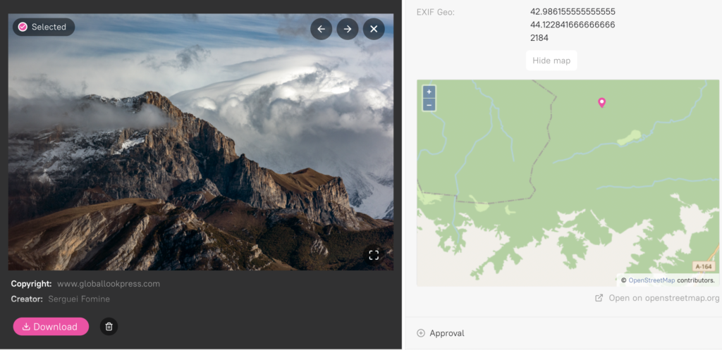
Geological property fields
Addition of a new type of metadata property type — geolocation for data from GPS.
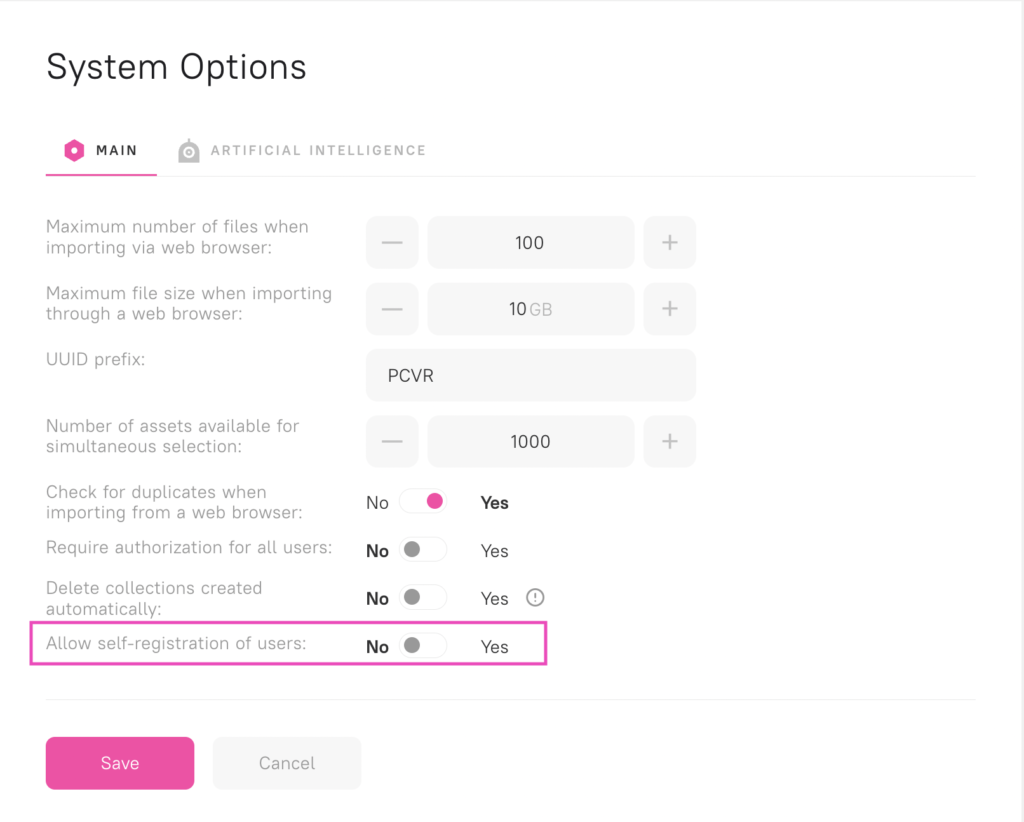
Internal registration of users in company space
The administrator can activate the registration of users in the Picvario space. To enable: go to System Settings > Options > Allow registration of users. The function is only available on the Enterprise plan.
After activation, a registration form in yourpicvariospace.picvar.io/login will become available. Once a user is registered, the administrator will receive an email about the new registration, and the user will be added to all groups marked as default and with permission.
Improvements to the existing functionality:
- Import log. Users can download the import log by clicking the
 icon. Import log can be downloaded in the interface and used to share information with technical support.

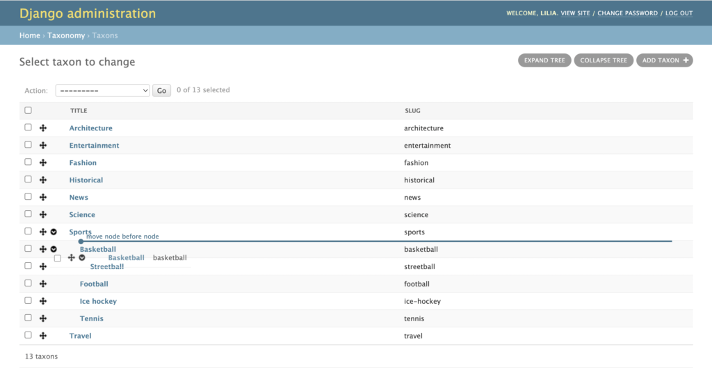
2. Ability to order the taxonomy on the platform. The setting is available in the Django Home > Taxonomy > Taxons.
3. Additional permissions for a user or group actions when working with collections (add/exclude/main). All users with rights to edit the asset will automatically to updated to the new permissions.


